


The Karakoram Highway runs south from Kashgar across the Khunjerab Pass at nearly 5000m all the way down to Islamabad in Pakistan. Khunjerab means ‘Valley of Blood’ from the days when bandits guarded the pass and plundered anyone foolish enough to come through this way without the protection of a small army. The name Karakoram comes from the days of the Mongol Empire who used this route to reach their south Asian territories, Karakoram was the capital of the empire at the time.
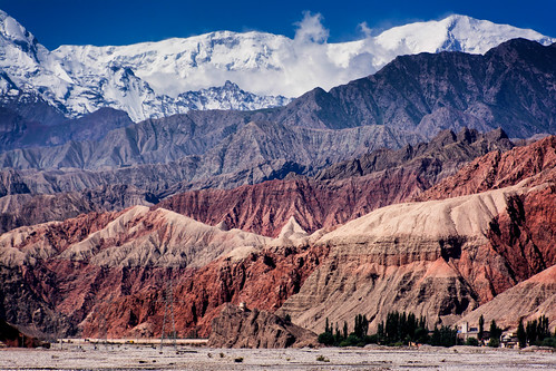
I’ve joined a car for a couple of day’s tour exploring up these parts as the prospect of sitting on a bus looking at closed curtains and passing all the best scenery didn’t appeal too much. We head south across the Kashgar oasis and gradually into more dusty plains for a couple of hours before hitting the abrupt line of the northern flank of the Himalayas and into the Ghez Canyon which climbs all the way up to the high plateau through sheer sided walls with glimpses of high icy peaks way above.
When upgrading a road in China, the strategy seems to be to rip up the entire length in one hit, then maybe work on a little bit at a time occasionally while the rest of the stretch goes to hell turning a one hour trip into a five hour 4WD adventure. That was the lucky experience along the length of the canyon with most of the road reduced to single lane mud and rock – add to this the habit of drivers in China to drive at each other in an endless game of chicken, it added a bit of spice to journey. On the plus side, you don’t want to be in a hurry driving through this kind of scenery.
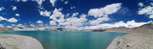
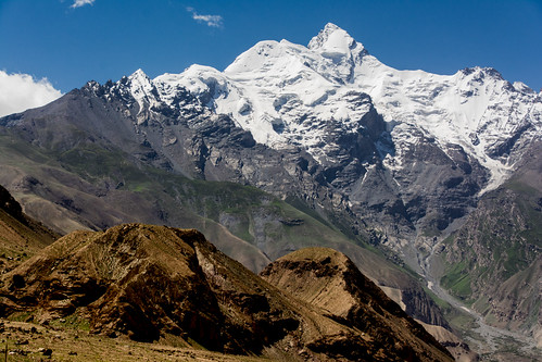
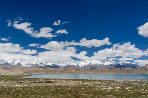
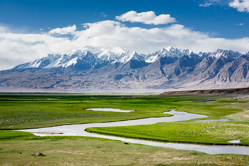
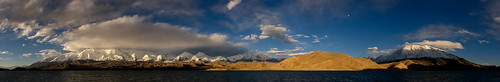
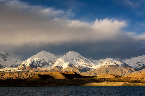
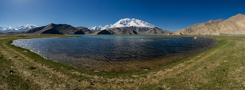
Eventually, back on proper road, we popped out at a dazzling blue lake surrounded by sand dunes of the Sarikol Pamir at around 4000m, and pass through an ever increasing scenery as the two massive peaks of Kongur and Mutzagh Ata mountains loom up at over 7500m each. We stop Karakul Lake for some amazing views across to these mountains, the ice bound tops and massive glaciers tumbling down the valley towards the lake with great reflections.
The road beyond takes over more high passes and through deep green lush valley floors dotted with round nomadic tents with grazing yaks and camels, flanked by stark barren mountains. Tajikistan and Afghanistan lie just over the ridge to the right.
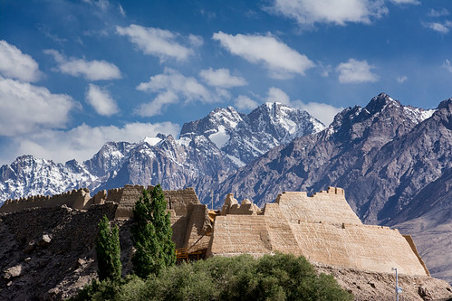
We reach the small city of Tashkurgan set in a broad valley walled in by two long lines of imposing mountains. The 1400 year old fort gives incredible views of the vista in all directions (it was used in the filming of The Kite Runner). It feels far removed from China up here, more part of a Central Asian republic, with the predominant Tajik people and landscape more reminiscent of Afghanistan or Iran.
We have a great couple of hours wandering the fort and the grasslands below before heading back to Karakul Lake for the night.
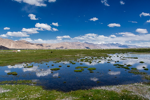
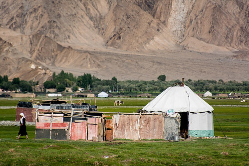
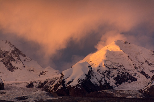
By the time we reach the lake, the sun is angling low through high snow clouds making for some dramatic lighting as the day draws to a close. We stay in a nomadic tent and the temperature plummets (the tents inside are incredibly warm, fuelled by a hearty yak dung fire): clear skies, 4500m altitude and the proximity to so much snow and ice don’t make for balmy evenings.
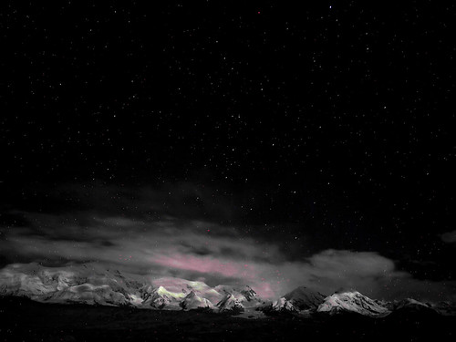
The night sky is incredible with the Milky Way arcing overhead, the high Himalayas lit up by a bright moon. It’s a stunning sight to see which lasts as long as my ability to not shake violently with the cold.
Morning breaks with clear skies and more superb scenery. A few hours kicking around the lakeside and it’s time to head back to Kashgar and on to a flight to Beijing to pick up my Mongolian visa to begin the next leg of the adventure. This is the end of the Silk Road for me ….


These photos are incredible!
LikeLike
Thanks 🙂 The scenery out that way is absolutely fantastic 🙂 Definitely a highlight of the China trip so far.
LikeLiked by 1 person
brilliant following your travels Rich, amazing photos
LikeLike